Parts 1 and 2 of The Katoomba Coal Mine, a paper published in March 1972 and written by Joseph Ralph Bennett for the Blue Mountains Historical Society, who own the copyright. It details the involvement of John Britty North in the coal and shale mines and in the foundation of the township of Katoomba. The paper was reprinted in 2007 and is reproduced here with the Society’s permission. Part 3 deals with the mine subsequent to 1923. The complete paper can be sourced from the Society.
KATOOMBA COAL MINE
PART ONE
JOHN BRITTY NORTH
“THE FATHER OF KATOOMBA”
A more appropriate paper could not be written on Katoomba than that of John Britty North, so aptly named “The Father of Katoomba” and his enterprise of opening up the Coal Mine in South Katoomba. Nature endowed him with an exceptionally strong character, and after a study of the very scattered records that can be found of him one realises that a man of his stamp does not often appear, leaving his mark for all time.
It is not quite known when he first came to the Blue Mountains, but it would be about the year 1870. Here he found what had been hidden for untold ages the rugged grandeur of Mountain Scenery, Beautiful Falls and charming Valleys. There came to him a prophetic vision of what was to be. Possessing boundless energy, comparable courage coupled with an indomitable will, he laid the foundation of this city which we now proudly boast of as “The Premier Tourist Resort of the Commonwealth”.
John Britty North was born on the family estate near Taunton, Somerset, England in the year 1831. He arrived in Sydney New South Wales in 1854, together with his parents, two brothers and three sisters, his age then being 23 years.
His keen and deep search for hidden wealth led him to discover the rich deposits of Coal and Shale and within twelve months after his arrival he had a number of men opening up mines at South Katoomba. Here a little village sprang up composed of over one hundred cottages.
We will find, in the following pages of his paper, that the opening of the mines was the signal for the rapid advancement of the district and so stupendous an undertaking by a single individual, is without land as parallel in this country. He discovered many of the beauty spots and made them accessible by the construction of roads.
In 1872 whilst working on the organisation of the mines, he became one of the founders of the Sydney Stock Exchange and in 1878 registered a company under the title of “Katoomba Coal Mine”. It has generally been known that his first home in Katoomba was “Essendon”, often referred to as “Essendene”. He rented it from the owners Mr. and Mrs. Henderson. The building was situated at the junction of the Great Western Highway and Cliff Drive. In later years it was used as a private school and also as a guest house. For many years it was untenanted and became a stopping place for “Swagmen” who tramped the countryside along the highway; about 1940 it was destroyed by bushfires. North build a permanent home in Katoomba Street when it was little more than a bush track, he called it “Lossie Brae”. It was built on the lower side of the store which carries the name of “Woolworths”; it was demolished when Katoomba Street became the business and shopping area.
North also built the first house in the Sydney suburb of Wahroonga, he named it “Linton” and for some years resided there.
Some rather conflicting stories have been told about him, as he was such an exacting man. Inadvertently he was dubbed the “Crusher”, but, reviewing the work he put into the mine and the community, the tenacity he showed in overcoming the many obstacles and problems he was continually confronted with, the name “Father of Katoomba” would be more in keeping. (There was a man, however, known as the “Crusher”, his name was Joseph Edwards, he was North’s overseer at the mine.)
From the old maps surveyed by W. A. D. Greaves in December 1875, it can be seen North realised in those early days the potential the mountains would have to offer in the years to come. He took up many acres of land, some of which became Katoomba Street. This portion it appears was an original grant or purchase by Montague Levey, a later map dated April 1878 shows the names of R. H. Reynolds and J. B. North, apparently they purchased the land from Levey. To the West of Katoomba Street, North owned all the land as far as Shell Corner. From the railway to his mining operations in South Katoomba, the land was mostly owned by the London Chartered Bank of Australia and Montague Levey, it was across this land North constructed a tramway from the engine bank to the railway proper. North owned most of the land along the cliff frontages from the Three Sisters, then known as “Tria Saxa Point”, to the Narrow Neck and across to the Ruined Castle. Some portions were owned by Charles Smith and Thomas Sutcliff Mort, this land was mostly out towards the end of Clear Hill.
He was a man who took a great interest in community work and when the Katoomba Progress Committee was formed he was appointed its first chairman. The area covered by the committee had a radius of six miles from the railway station. During his period on the committee he proposed a levy of 1/- per person on people who wished to vote for the candidates; a proposition which was lost by a vote of the committee. On another occasion he was successful in forming a subcommittee to inspect a portion of Katoomba Street with a view to its reconstruction; householders were to be asked to contribute to the cost but, owing to the unsatisfactory replies received, the matter was shelved. One matter which cropped up on many occasions was the construction of a lake. North was obsessed with the idea, consequently the following article appeared in the Mercury, May 5th 1887:
The long-talked of lake for Katoomba is at last to be realised. The dam is now in course of construction, and, when completed, an area of fourteen acres will be covered with water, at an average depth of six feet, so that at no distant date it will be an accomplished fact to see boats in use on the mountains, and through the enterprise of our worthy townsman, Mr. J. B. North, a source of attraction will be provided not possessed by any mountain resort in new South Wales.
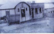
Centenial Hotel, South Katoomba, as it appeared in the “North Coal Mining Days”
The fourteen acres of land was donated to the community by Mr. North and the name given it was “Lake Esplanade” (this name is still shown on the old maps of Katoomba). “Buleah Fiats”, the building overlooking the valley from Cascade Street was built in anticipation of the lake being of great importance. The dam was constructed, but did not justify the vision of North, it was cleared away when the Catalina Racing Track was formed.
John North’s keen interest in developing the scenic beauty of the mountains was manifested by his appointment as Trustee of Katoomba, Leura, Banksia and Echo Parks along with three other gentlemen, John W. Fletcher, William Garden and George W. Morris. The work of these men was outstanding particularly in the Echo Point – Katoomba Falls area.
At a public meeting held on the 16th June 1889, called for the purpose of forming a Municipality, North outlined what work had been done by the Progress Committee. He said “Not wishing to dictate what should be done, but what was best to be done within the limited powers of a committee, with the formation of a municipality and a council comprised of reliable people a tax could be levied on all land and steps taken to improve the town”. He said he did not believe people should go “cap in hand” to the government for everything – they should have the right to say how their money was spent in a Municipal District.
John North did not stand for Alderman when the Municipal District was formed – the first council comprised of six gentlemen: F. C. Goyder (Mayor), Messrs. A. A. Smith, W. H. Edwards, Chas. James, D. Thompson and P. Mullany.
For a period he was an alderman of the council, his name first appeared in the records about March 1890, when he wrote to the council objecting to night soil being deposited on his land. He was elected to the finance committee in July 1890. At the meeting on July 10th he moved that a reserve road be constructed from the Post Office on the Bathurst road to the Centennial Hotel at South Katoomba. Apparently the Post Office at that time was at the corner of Cascade Street and Bathurst Road. Had the road been built it would have given him direct access from the railway station to the mine. His reason for the construction of the road must have been too obvious because he withdrew the motion almost as quickly as he submitted it. In subsequent years the road was built when the Western end of Katoomba was developed.
On another occasion he submitted to council an offer of money, which, together with that provided by the Trustees of the late T. S. Mort’s Estate, was to be used for the construction of a road into “Nelly’s Glen”. The council took no action concerning this work. As a matter of interest, North named “Nelly’s Glen” after his daughter “Nellie”.
His attendance at council meetings was all that could be desired, on one occasion he was fined One Pound for non-attendance. At the following meeting he asked that the fine be remitted but the mayor explained that this could not be done except by call of council to a special meeting and he, the mayor, did not feel justified in making the call. North retaliated by successfully moving a motion that in future special business be underlined in red ink on the notice paper and that his protest be recorded in the minutes. North resigned from the council twelve months later, his aldermanic connection with the council being less than two years.
When the matter of a Public School came up for consideration, North was one of the main instigators to have the school established. With the assistance of the Rev. Thomas Harrison, he headed a petition to the Education Department for the establishment of a school. He followed this up with an official application signed by himself and Mr. Henry Barber, a storekeeper. North offered the department a site for the school at the junction of Valley Road (then called Megalong Road) and the Great Western Highway. He wrote “this allotment is in the centre of the proposed township of Katoomba”.
Inspector Allpass from the Education Department inspected the site and recommended that the department accept it. The site measured 116 feet x 60 feet, but it was soon realised the area was not big enough. North then offered to sell five adjoining blocks for Four hundred and eighty one Pounds ten shillings an offer that was accepted.
With the purchase completed, North then became impatient to get the school under way and suggested a tent be used whilst arrangements were made for a permanent building. As a result of this suggestion the Chief Inspector recommended a tent be provided. The tent was duly erected by Messrs. Nelson & Smith and furniture was supplied by R. C. Troughton. The school was opened on 6th February 1882, the enrolment was fifty children and average attendance 27.2. An assistant teacher from Crown Street Public School, Mr. George Young, was put in charge but it was not a happy appointment for him and he only remained a few weeks. He was replaced by Mr. John Douglass who took the position in a temporary capacity, but subsequently remained permanently. Douglass remained in Katoomba for the next fifteen years.
The school had hardly been started when a dispute broke out over the site. Katoomba was only just beginning to be settled and it was doubtful where the centre of the town would be. Two opposing factions became established who fought bitterly over a new site for the school, consequently the Minister, Sir Frank Suttor, sent a senior officer to make an “on the spot” investigation. The inspector, Mr. Johnson, called a public meeting to assess the merits and demerits of the dispute. North won his point to have the school situated on the western end of the town. The department leased a building from him for a period of twelve months, a building that had been used for church purposes. The worshippers who used the building submitted a request that it be made available to them on Sundays for worship and Sunday School. The request was refused.
Very little could be found in the way of records of other activities of North after the school was established, but it seems his interests became centred on his activities at the mine.
As his family grew he gave a share of the mine to his son A. H. North and they worked it together. When John Britty North died his son A. H. North bought the mine, land and tramway from his sisters, to whom J. B. North had left the whole of his estate.
John Britty North died on the 13th October 1917 at Wahroonga, New South Wales, his age then being 86. He was buried beside his wife, who predeceased him by 11 years. They are buried in Gore Hill Cemetery, St. Leonards, N.S.W.
Memorials to John Britty North’s father, who bore the same initials (J.B.), his two brothers and three of his six sisters can be found in the same cemetery.
A fitting tribute was paid to this great man by an article which appeared in the Blue Mountains Echo of March 6th 1909. It reads:
Of the esteem and estimation in which Mr. North is held by a large circle of friends and admirers it is unnecessary for us to speak, but we feel convinced that posterity will recognise his work and his worth, and on a conspicuous spot in Katoomba a monument will arise as a fitting tribute to the memory of one of the most worthy, the most generous and kindly natures in human history.
KATOOMBA COAL MINE
PART TWO
ORPHAN ROCK – RUINED CASTLE – MEGALONG
Prior to John Britty North’s coming to the Mountains and mining for coal, the Reverend W. B. Clark, a Geologist, reported in 1841 the presence of coal in the Blue Mountains. In the late 1860s Mr. Campbell Mitchell discovered coal when he explored the country for coal bearing deposits between what was then known as “Jones’ Wayside Hotel” and “Weatherboard” (Wentworth Falls). This took in the area now known as Katoomba.
The portion then known as “Jones’ Wayside Hotel” is about one mile from the Explorers Tree and on the opposite side of the railway line. It now forms part of the Blue Mountains City Council Catchment Area, being commonly known as “Cherry Tree Flat”, a name coined from the fact that the licensee planted a great number of cherry trees in and around the hotel. The old road built by William Cox runs through it and a few hundred yards from the flat is an old quarry, said to be that from which Cox took the stone to build the road.
During this exploration work, Mitchell, assisted by Mr. J. Flynn, a surveyor from Hartley, discovered Kerosene Shale in the Megalong side portion of the Kanimbla Valley and in conjunction with Mr. Thomas Sutcliffe Mort took up land embracing the area subsequently known as “The Glen Shale Mine”, portions 14 and 15, Parish of Megalong, County Cook.
After securing the land, the question of extension of the Kerosene Shale through the narrow Megalong Mountain (Narrow Neck) into the Jamieson Valley on the East side was considered. Mitchell proceeded to explore the latter area leaving Mort and Flynn on the Megalong side. Land, however, was not taken up at that time in Jamieson Valley on account of its inaccessibility from the Great Western Railway.
